OruxMaps GP
jose vazquez
Preview
Overview
Core Features
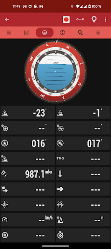
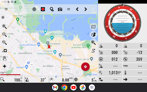
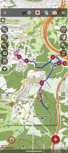
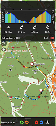
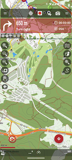
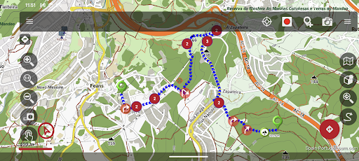
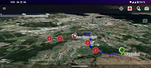
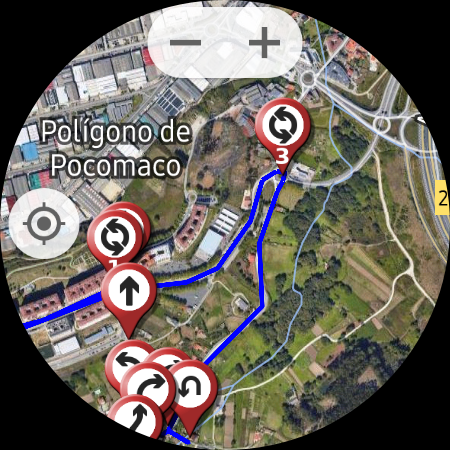
- The app features detailed map navigation with customizable routes for various outdoor activities like hiking and cycling.
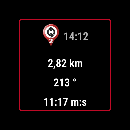
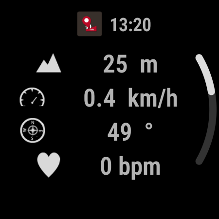
- Real-time GPS tracking allows users to monitor their location and movement accurately during adventures.
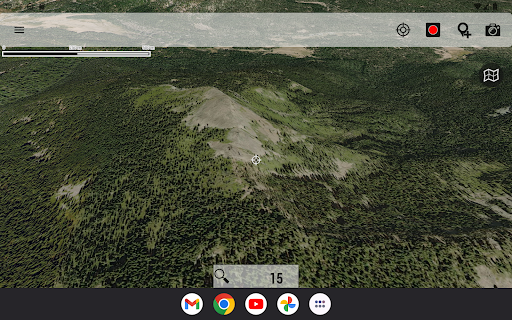
- Offline map support ensures navigation is available even without internet connection, enhancing usability in remote areas.
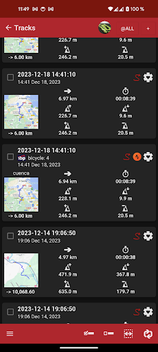
- Data import and export options facilitate easy backup and sharing of routes and waypoints, improving app experience.
- Battery-efficient design helps extend device usage during long outdoor trips without draining power quickly.
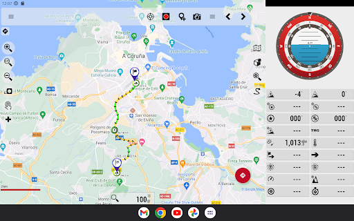
- Built-in support for multiple map layers offers users diverse visualizations suited to different outdoor settings.
- The app includes detailed tracking statistics to analyze and improve navigation efficiency over time.
Who This App Is For
This mobile app is ideal for outdoor enthusiasts, hikers, cyclists, and adventure travelers who need reliable navigation tools. It suits users of various experience levels, from beginners to seasoned explorers, seeking an efficient app-based solution for travel and exploration.
Whether planning day trips or extended journeys, users can benefit from this Android app's robust features to enhance safety and navigation accuracy in diverse environments. It's perfect for those who want a versatile app experience that supports offline usage and detailed route management.
Why Choose This App
This Android app offers a comprehensive set of app features designed for outdoor navigation, making it a trustworthy choice for adventurers. Its ease of use and offline capabilities set it apart from other travel apps, ensuring users stay connected with maps at all times.
By providing real-time GPS tracking and customizable route options, this app solves common navigation problems encountered during outdoor activities. Its reliable performance and user-focused design make it a top app-based solution for travel and local exploration enthusiasts.
Features
1. Robust offline maps for remote exploration
2. Extensive map format support for versatile navigation
3. Effortless route creation and editing tools
4. Seamless external device connectivity options
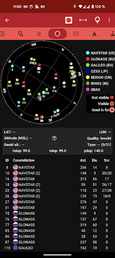
5. Reliable GPS and sensor data integration
6. Personalized waypoints with multimedia attachments
7. Interactive sharing of location and trips
8. Enhanced outdoor adventure experience with custom features
More Information
OruxMaps GP is a versatile Android app designed for outdoor enthusiasts, travelers, and navigation fans. It offers an intuitive platform for mapping, tracking, and planning routes, making it a comprehensive app based solution for offline and online navigation. With its rich app features, users can enhance their app experience whether exploring new places or managing outdoor activities.
👍 Pros
- Offline Map SupportOruxMaps GP allows users to download and use maps offline, ensuring navigation even without internet access, which is crucial in remote areas.
- Highly Customizable TracksThe app offers extensive track recording options with customizable parameters like speed filters and recording intervals, catering to different outdoor activities.
- Multi-Map Source IntegrationSupports various map sources such as OpenStreetMap, Google Maps, and custom map layers, providing versatility for users.
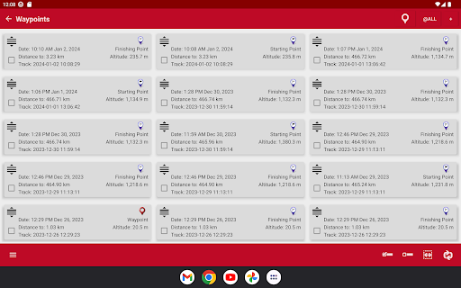
- Advanced Waypoint ManagementEnables adding, organizing, and navigating to waypoints efficiently, useful for complex navigation tasks.
- Rich Data Import/ExportAllows importing GPX files and exporting routes, facilitating data sharing and analysis.
👎 Cons
- Steep Learning CurveNew users may find the interface complex and need time to learn various features, but official tutorials are expected to improve onboarding.
- Limited Real-time Traffic UpdatesThe app does not support real-time traffic data, which can affect routing accuracy in urban environments; users can temporarily rely on other navigation apps or updates until future versions include this feature.
- Battery ConsumptionContinuous GPS usage can drain device battery quickly; users can mitigate this by adjusting recording settings or using external power sources.
- User Interface DesignSome users find the UI outdated or cluttered, but future updates are anticipated to enhance visual clarity and usability.
- Limited Free Map LayersWhile many map sources are supported, some premium layers require payment; users can choose open-source options or wait for additional free layers provided by the community.
Download OruxMaps GP
You are going to be redirected to the official website to finish the download when you click these buttons above.