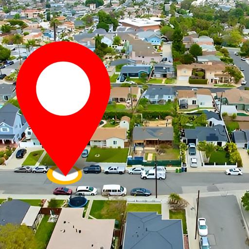
Satellite Map Live Earth View
GPS Driving & Voice Navigation Apps
Preview

Overview
Core Features
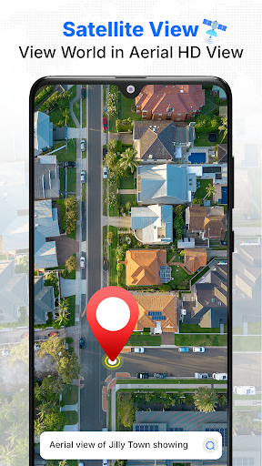
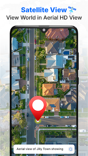
- The app features real-time live earth viewing with detailed satellite imagery for accurate geographic insights.
- Users can explore different layers, including terrain, roads, and landmarks, enhancing navigation and planning.
- High-resolution satellite images provide clear visuals, making it easier to identify locations and terrain features.
- Built-in GPS tracking ensures precise positioning, crucial for outdoor activities and travel navigation.
- This mobile app supports offline mode, allowing users to access maps without an internet connection.
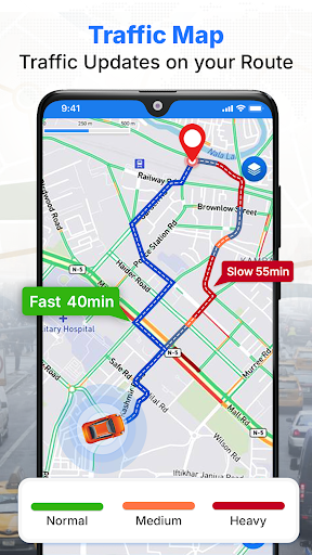
- The app features live traffic updates, helping users plan routes efficiently and avoid congestion.
- Integration with a launcher app makes it simple to access satellite maps directly from the home screen.
Who This App Is For
This travel and local app is perfect for outdoor enthusiasts, travelers, and explorers seeking accurate earth views and navigation on their Android devices.
Whether you're hiking, planning trips, or exploring new areas, this app-based solution offers reliable satellite maps to enhance your journey and outdoor experience.
Why Choose This App
This Android app stands out with its combination of detailed satellite imagery and user-friendly features, delivering an exceptional app experience.
It offers a comprehensive app-based solution for navigation and earth viewing, helping users find the information they need quickly and reliably, making it a smart choice among many similar apps.
Features
Explore the Planet with Real-Time Satellite Visuals
High-Quality Global Satellite Imaging Experience
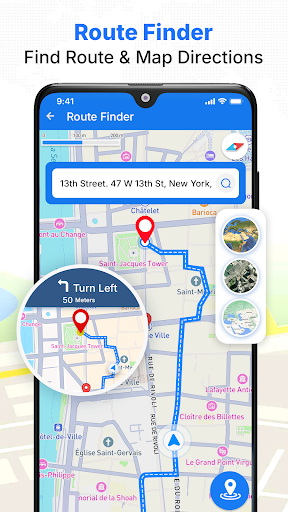
Navigate Effortlessly with Accurate GPS Guidance
Precise Route Planning and Voice Directions
View Detailed Maps and Live Location Updates
Real-Time Street and Traffic Data
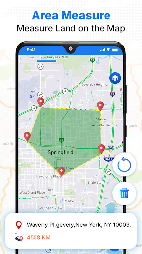
Enhance Exploration with Interactive Map Tools
Zoom, Layer Customization and Area Measurement
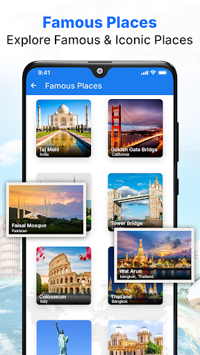
Enjoy Virtual Travel and Landmark Tours
Immersive 3D Views and Virtual Landmark Exploration
More Information
Satellite Map Live Earth View is a reliable travel and local app that provides real-time satellite imagery and detailed Earth views. Designed for Android devices, this mobile app offers an immersive app experience by allowing users to explore the planet from their smartphones with accurate and up-to-date map features. It serves as a useful app based solution for travelers, outdoor enthusiasts, and anyone interested in geographic visuals.
👍 Pros
- Real-Time Satellite ImageryProvides up-to-date live views of Earth's surface, ideal for current events and weather monitoring.
- High-Resolution ImagesOffers detailed satellite images that allow for clear viewing of landscapes and urban areas.
- Global CoverageIncludes comprehensive mapping of most regions worldwide, accessible anytime.
- User-Friendly InterfaceFeatures easy navigation with simple controls suitable for all user levels.
- Multiple Map LayersSupports various overlays like weather, terrain, and political boundaries for enhanced context.
👎 Cons
- Limited Offline AccessMost features require internet connectivity; offline mode is limited, which can hinder use in remote areas.
- Battery ConsumptionContinuous live viewing can drain device batteries quickly; users might need portable chargers.
- Occasional Image LagReal-time images may sometimes load slowly due to server issues, but official updates may improve speed.
- Limited Historical DataLacks access to historical satellite imagery for comparison; future updates may enhance this feature.
- App Size and Storage UsageThe app can be sizeable and may take up significant storage; developers may optimize in future releases.
Download Satellite Map Live Earth View
You are going to be redirected to the official website to finish the download when you click these buttons above.